Experience the Southern Virginia Wild Blueway, where three rivers and two lakes span Halifax and Mecklenburg counties. This unparalleled paddling destination offers untouched landscapes, abundant wildlife, and easy access from major metro areas. Whether you seek a leisurely lake excursion or a challenging multi-day river adventure, the Blueway delivers.
In this series, written and reviewed by paddling enthusiasts, we’ll look at a different part of the Blueway with each post. Posts will break down the river and lakes into sections based on publicly accessible boat ramps, along with a description of the area, milage, time estimates, and wildlife you may encounter. The second section to be examined in the series is Banister Lake and the Banister River.
Banister Lake
The Banister River originates near Chatham, VA and flows southeast through Pittsylvania and Halifax Counties, meandering through the Piedmont Plateau. As the river enters the Town of Halifax, it encounters a small dam that forms the picturesque Banister Lake on the town’s outskirts. The lake has a maximum depth of 30+ feet at the dam.The old river channel depth ranges from 6 to 13 feet on at mean water levels.
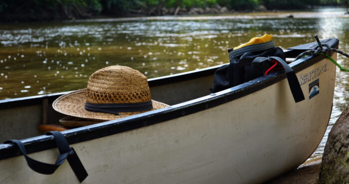
While the lake can be appreciated from the shore, there is much more to discover by embarking on a canoe or kayak adventure. A convenient boat launch with ramp and courtesy pier for motorized craft, renovated in 2018, is located just north of downtown Halifax, adjacent to the L.P. Bailey Memorial Highway (US 501) bridge. Positioned upstream of the dam, this facility offers access to the flat water of the lake which can be further explored by boat or kayak.
Probably one of the best kept Virginia fishing secrets, Banister Lake offers a plentiful supply of largemouth bass, sunfish, crappie, and catfish.Five-to-nine-pound largemouth bass aren’t unusual. This serene lake also offers bird watching opportunities and the chance to see native wildlife. The Banister has several coves ideal for privacy and relaxation, or for casting a line.
Upon taking out of the water, the shops and restaurants of Halifax are only a couple of minutes away – ideal for provisions before your adventure or grabbing a bite to eat after an afternoon on the water.
Banister River
Below the dam, the Banister continues before meeting the Dan River near Staunton River State Park. This section of the rivers features picturesque landscapes, winding passages, occasional rock outcroppings, and traces of historical features. The river’s serene environment is characterized by its remote and isolated nature, with minimal human intervention except for infrequent private structures. The dense canopy along the river contributes to a sense of intimacy. However, the scenery changes as the Banister River and the Dan River convergence, where the canopy opens up, and longer panoramic views become possible. The river’s generous buffers and stream canopy also create a haven for wildlife, with the sounds of songbirds accompanying the soothing flow of water. In-stream and stream-side rock formations add further charm to the Banister River’s natural beauty. These factors led to a total of 63.3 miles of the Banister being designated as a Virginia State Scenic River in 2014.
The riverbanks are adorned with streamside vegetation, offering ample shade with overhanging branches. Paddlers should remain mindful of fallen trees, which may hinder navigation and require short portages, especially during low water levels. Some of these fallen trees can pose hazards during high water conditions, creating inescapable traps.
Though plans currently exist to create a river access point where Meadville crosses the Banister above the lake, currently there is only one access facility on the river below the dam – King’s Bridge Landing (canoe/kayak hand launch only), near Downtown Halifax, completed in 2015. However, the Banister is crossed by several bridges downstream on US Army Corps of Engineers land that locals use to access the water. While these are public property, it is important to remember that crossings may have steep banks, unmaintained foot paths, and little to no parking. As a result, caution should be used when launching or removing a boat from these locations.
- King’s Bridge Landing ->US 360 Bridge (James B. Hagood Memorial Highway)
- US 360 Bridge -> Wolftrap Bridge (Rte. 716)
- Wolftrap Bridge -> Staunton River State Park
Put In: King’s Bridge Landing (1041 Bethel Road, Halifax, VA)
Take Out: US Highway 360 (Just South of Terry’s Bridge Road/613 on USACE Wildlife Management Area Parking)
Distance: 6.2 miles
Estimated Time: 2.5 – 4 hours
Put in: US Highway 360 Crossing
Take Out: Rte. 716 Wolftrap Road (USACE Wildlife Management Area Parking)
Distance: 3 miles
Estimated Time: 1 – 1.5 hours
Put In: Rte. 716 Wolftrap Road Crossing
Take Out: Staunton River State Park-Rte. 782
Distance: 9 miles
Estimated Time: 4 – 5 hours
Know before you go: Estimated times and distances are from oldhalifax.com. Virginia law requires wearable lifejackets for all passengers of a boat (both motorized and paddle craft). Life jackets must be readily accessible if not worn. Federal law states children under the age of 13 must always wear a lifejacket while on the water; most rivers in Virginia are considered federal waters. As many stretches of the river are remote with limited cell phone service, be sure to check the weather forecast and prepare accordingly. Additionally, current water levels can be found here: waterdata.usgs.gov/nwis